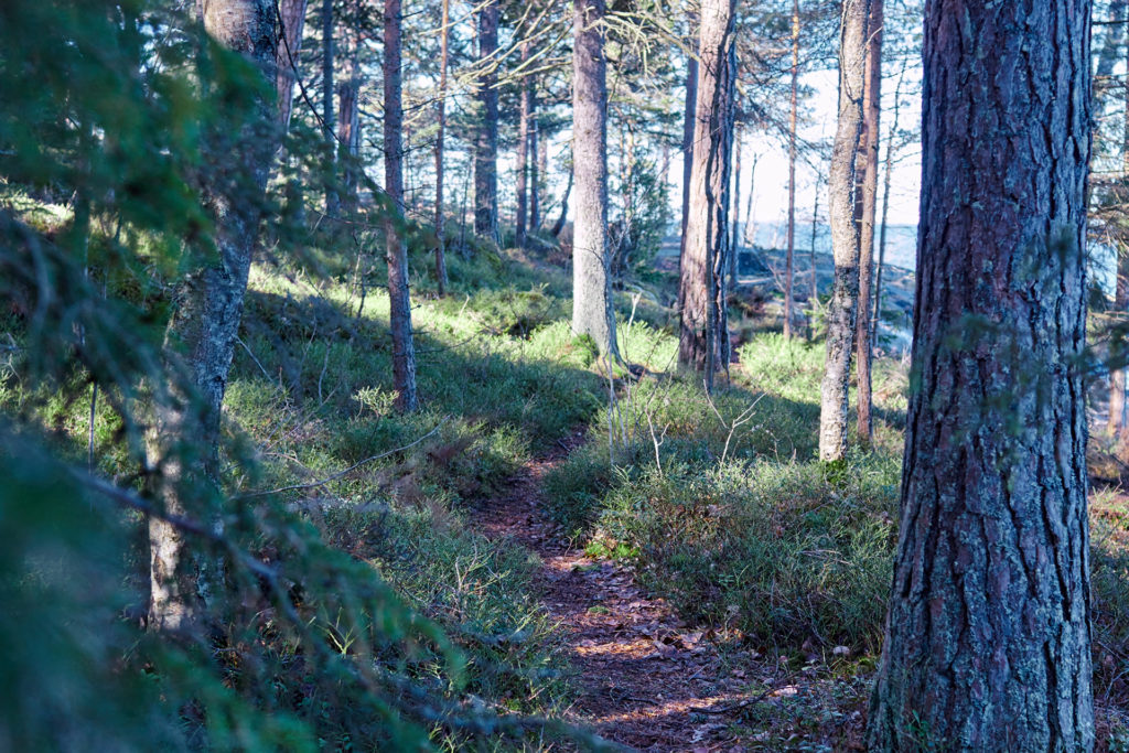
Hiking trails
Around Söderlångvik Manor on Kimitoön, there are trails and hiking routes that are well marked and vary in length and difficulty.
Digital versions of our hiking trails are available on Karttaselain.
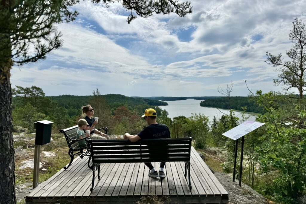
The Park Trail
The Park Trail starts at restaurant Amos Krog. Along this trail, you can read about the history of Amos Anderson and Söderlångvik Manor.
Park Trail Audio Tour
Instead of stopping to read the information boards, you can listen to the Park Trail audio tour. It is available via our digital guidebook, which you can access by scanning a QR code. The QR code can be found on the Park Trail signs as well as around the estate.
Length: 900 m one way
Difficulty: easy
The Mona Trail
The Mona Trail is named after the actress Mona Mårtensson. The path starts near the museum and Amos’ garage, goes through the park and continues along the waterfront and on through the apple orchard. There are several charming buildings along the route, and you can read about the history of the Konstsamfundet association and the management of the properties in the trail guide.
Length: approx. 1.7 km
Difficulty: easy
The Ladybug Trail
The Ladybug Trail can be enjoyed by hikers of all ages. It takes you up to Utkiksberget, a vantage point on the eastern edge of the manor grounds. Here you can see two ancient tombs from the Bronze Age. From the hill you can look out over Söderlångvik Manor and its beautiful surroundings
Length: approx. 1 km
Difficulty: challenging terrain, quite steep and slippery when it rains
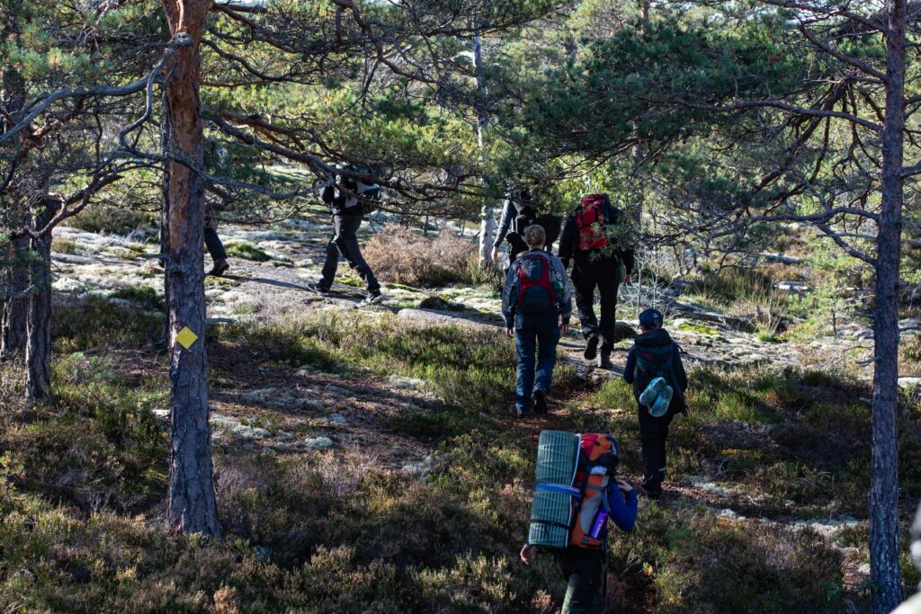
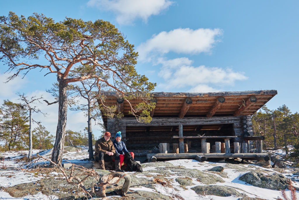
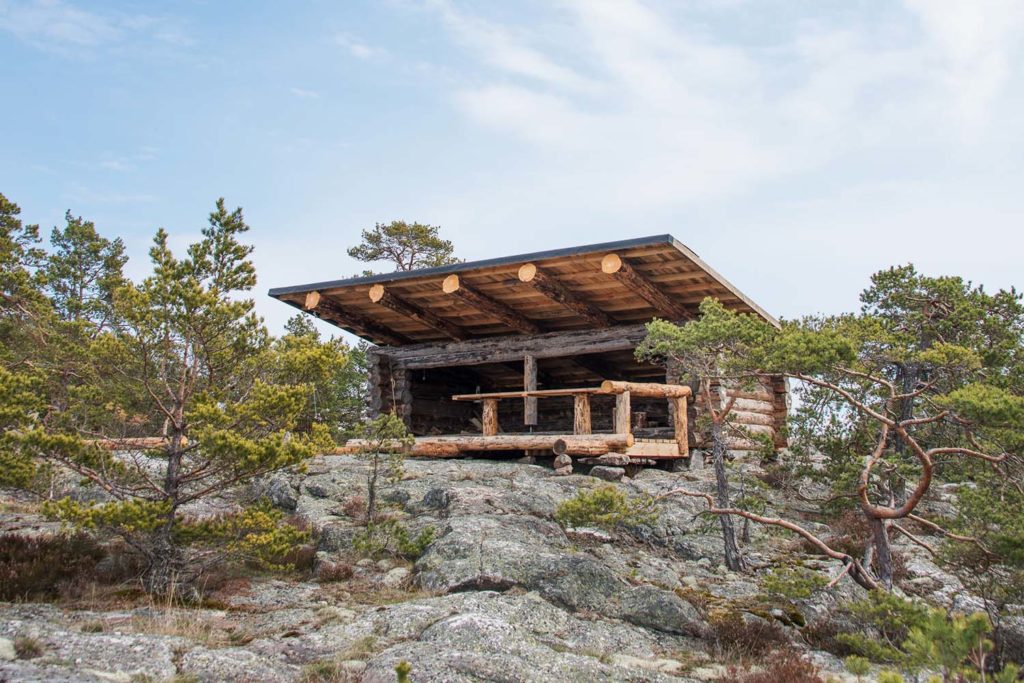
The Lean-to
On a high cliff, about two kilometres southwest of the manor there is a lean-to where you can rest. The trail leading to the shelter offers a slightly longer trek through the archipelago forest and a breathtaking view from the top of the cliff. You can start on this trail a little ways along Sundsvedjavägen. The signs along this path tell about Söderlångvik, Southwest Finland and the arts association Konstsamfundet.
Length: approx. 5 km (both directions altogether)
Difficulty: forest and mountain terrain
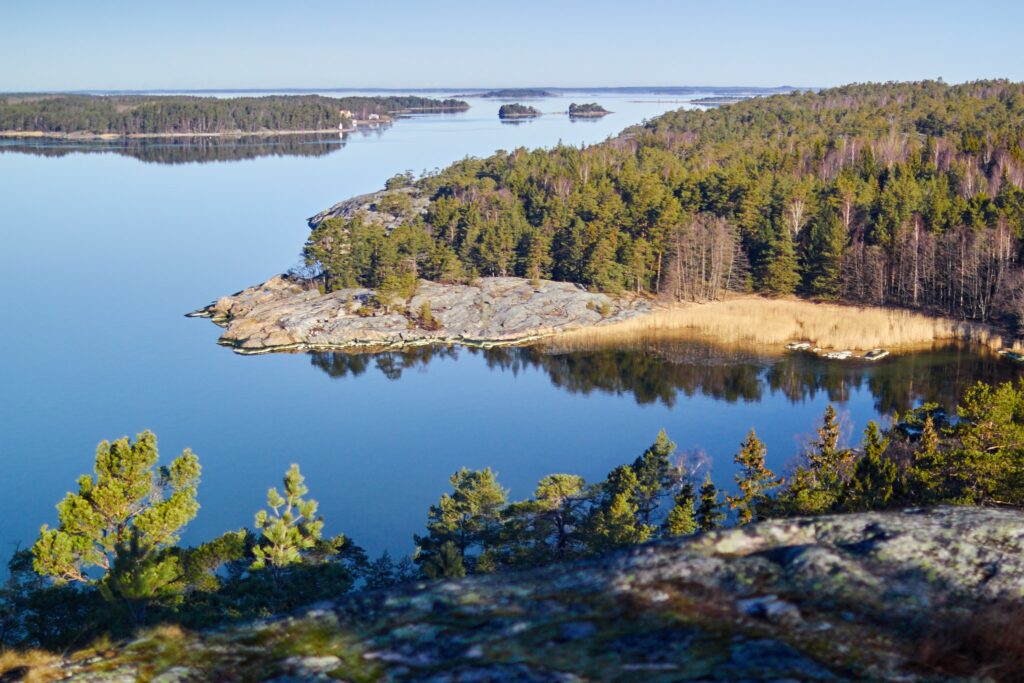
The Purunpää route
In July 2019, a private nature reserve of approximately 200 hectares was established in Purunpää. All activities involving strictly economically-driven forestry ceased when the area was established as a nature reserve. The reserve is now developing at its own pace, and Söderlångvik Manor honours the area’s nature reserve status by increasing biological diversity.
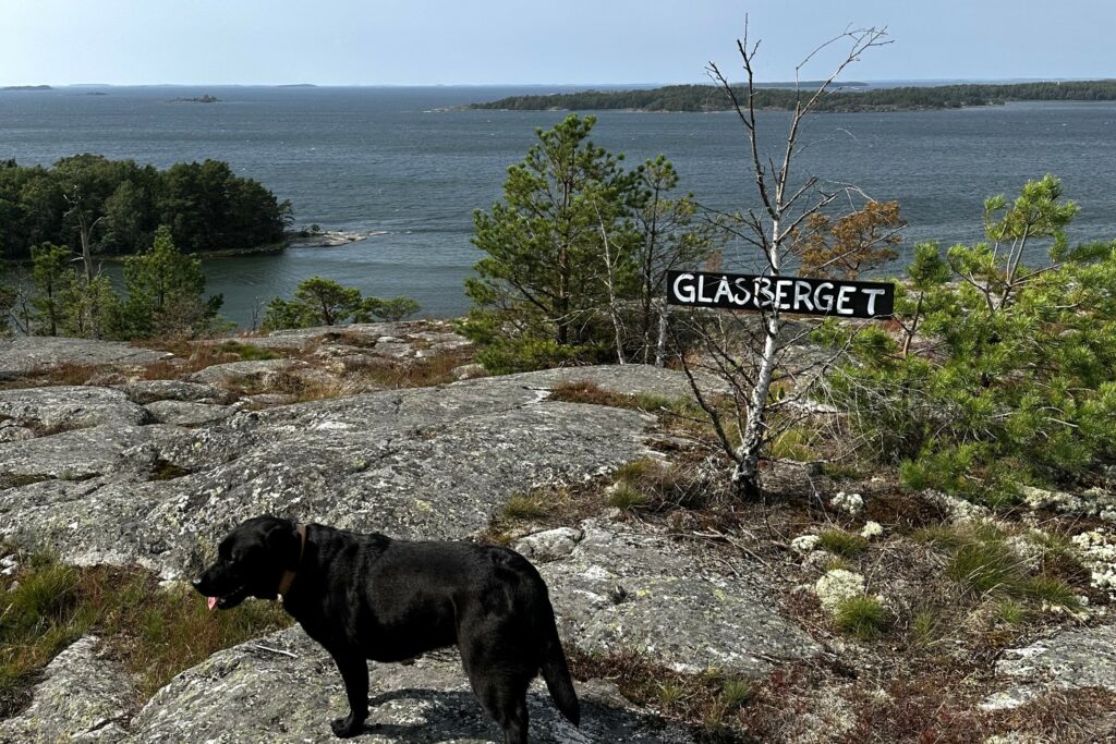
The nature on the point of Purunpää is unique, and the headland acts as a gateway to the outer archipelago. The area offers varied terrain: rich groves, barren cliffs and the ever-present sea. From the top of Glasberget, you can get a magnificent view of the Archipelago National Park.
Purunpää is characterised by heathlands and peatlands, forested hills, cliffs and rocky fields. A survey found Purunpää to have unique natural values. There is a significant population of ground-nesting birds, including capercaillie and black grouse. This is a reflection of efficient hunting of marten and mink at Söderlångvik Manor.
Purunpää is popular among nature lovers. Söderlångvik Manor welcomes visitors to enjoy this beautiful landscape! Please be aware that you are not allowed to access the area by car. There is a boom barrier on the forest road in the area. The hike to Glasberget and back is altogether six kilometres. It is forbidden to camp overnight or build a fire in the area. But you are welcome to pick berries and mushrooms!
This and other routes are also marked in an electronic map brochure compiled by Visit Kimitoön.
Length: 18 km (at its longest, also possible to walk shorter alternatives)
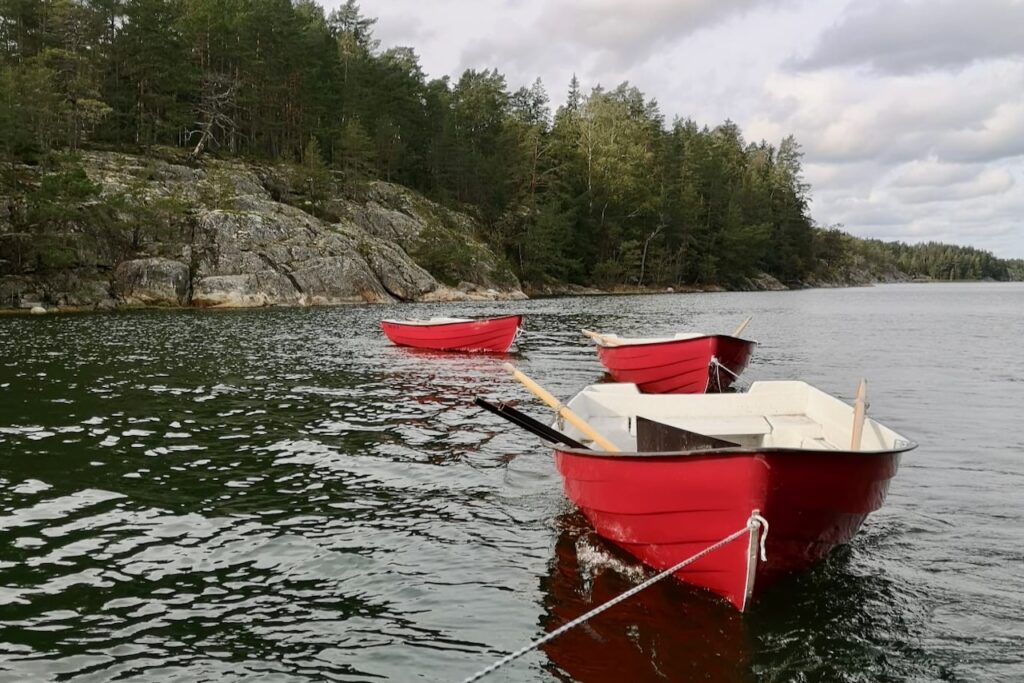
Difficulty: forest and mountain terrain. Rowing boats available in the sound between the Purunpää and Långvik peninsulas. The rowing boats are removed for the winter and are placed at the sound again in spring.
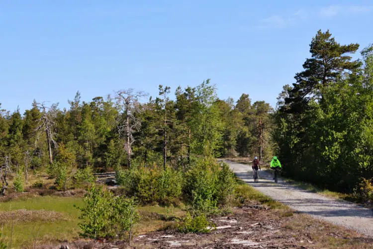
Söderlångvik Gravel
Söderlångvik Gravel was launched in spring 2024. The route starts at Söderlångvik Manor, where there is ample parking for both cars and bicycles. The route consists mainly of gravel roads, so a suitable bicycle is recommended. The route is not marked in the terrain, but you can download and print it or view it on your mobile device.
Kimitoön Activity Map: Söderlångvik Gravel
Download route map (PDF)
Stage 1: Söderlångvik Manor – Ölmos, 10.5 km
Stage 2: Ölmos – Purunpää, 11 km
Stage 3: Purunpää – Sundsvedja, 7.5 km
Stage 4: Sundsvedja – Söderlångvik, 3 km
Total length: approx. 32 km
Terrain: gravel roads, forest and rocky terrain.
Rent an e-bike and explore Söderlångvik’s gravel routes.